After staying overnight (again) in Moab, we made our way to Canyonlands - on the north end. This is an
interesting place. Frankly the name sounded like a generic description of
southern Utah but I was wrong. Talk about big. What immediately grabs your
attention is the scale of this park. In fact, you can make this statement at any
of the Utah parks. It’s just incredibly big. They all are.


1. Island in the Sky
2. White Rim Road
3. Needles
4. Maze
5. Orange Cliffs Unit (Glen Canyon NRA)
6. Horseshoe Canyon
7. Green River
8. Colorado River
9. Cataract Canyon
Here's a view of a canyon that is at least 100 stories below our level.

Check out this view of mineral ponds in the valley floor below. Mining rights were licensed by the state of Utah. The water is azure blue - incredible vivid. See the Google Earth view below.

You can get a sense of perspective from this map view. Talk about a squiggly road. Get the picture - this place is enormous!

Three intrepid explorers...

Mike and the Canyon... hmmmm... sounds like the title of a B movie.
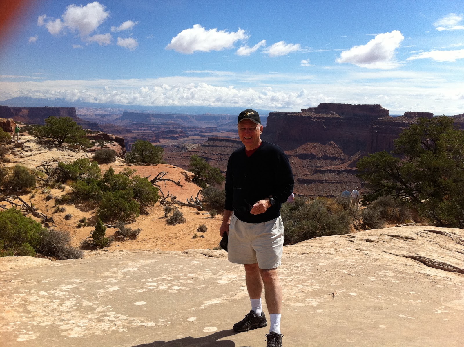
Another actor...

This road leads down to the mining (azure blue) operation below (like waaaay below).
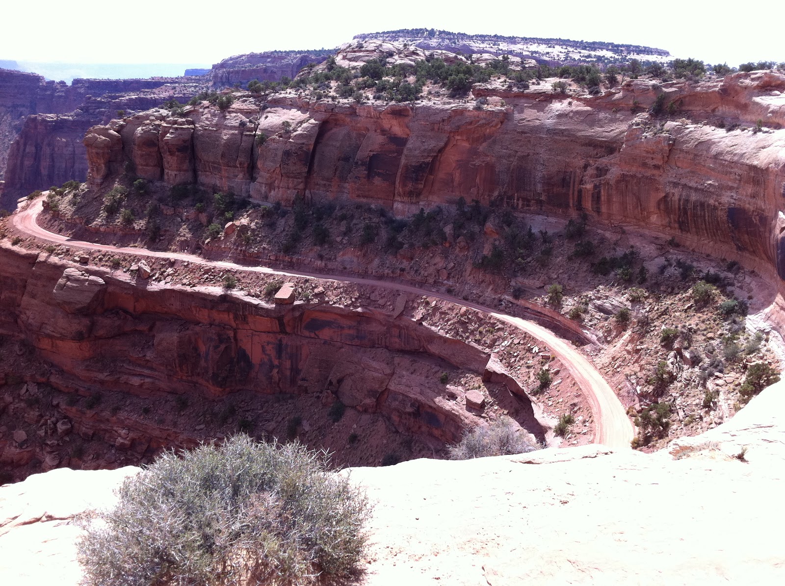
Check out the road in the valley that leads to the mining operation

First the land drops a thousand feet to the valley below, then it drops another 500' to the washout below that. Incredible. And for as far as the eye can see...


Marilyn checking out the Salt Dome explanation.
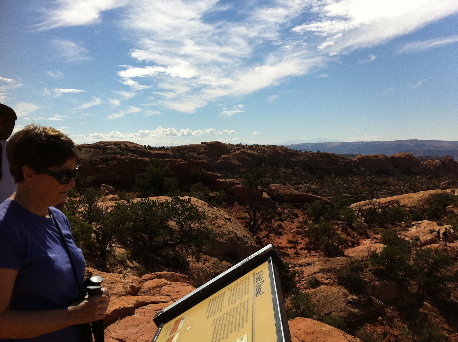
The Salt Dome is unique. Read more about how it was created.
Two significantly different processes have received serious attention from geologists and planetary scientists for explaining the origin of Upheaval Dome. One of these proposes that Upheaval Dome is the stump of a deeply eroded salt dome. The other suggests that the feature's shape is consistent with a complex impact structure.
Some investigators believed that a salt dome developed above the Paradox Formation and that it grew upwards, eventually detaching from the main Paradox salt and moved upwards through the overlying rock like a droplet of oil rising through water. Over millions of years the salt dome and surrounding rock were completely eroded. The feature that we see as Upheavel Dome today was thought to be the pinched off path left behind the rising salt dome located about 1500 feet above the underlying Paradox salt. The upturned orientation of these rock layers was formed when the salt dome pierced through them. No traces of salt are found today because it is such a soluble material. Larger photo here.

More on Salt Dome. Large photo here.

This is a good view of the Salt Dome - it's more than 2 miles across.

Marilyn looking back at the photographer...

Depiction of The Three Worlds. Large photo here.

The Grand View Point Overlook. Larger photo here.

You've got to wonder what geologic forces created these huge gaps.

And it goes on and on....

Must be a space craft coming in from Area 51.

Canyonlands
1. Island in the Sky
2. White Rim Road
3. Needles
4. Maze
5. Orange Cliffs Unit (Glen Canyon NRA)
6. Horseshoe Canyon
7. Green River
8. Colorado River
9. Cataract Canyon
Here's a view of a canyon that is at least 100 stories below our level.
Check out this view of mineral ponds in the valley floor below. Mining rights were licensed by the state of Utah. The water is azure blue - incredible vivid. See the Google Earth view below.
Potash Mining
View Larger Map
You can get a sense of perspective from this map view. Talk about a squiggly road. Get the picture - this place is enormous!
Three intrepid explorers...
Mike and the Canyon... hmmmm... sounds like the title of a B movie.
Another actor...
This road leads down to the mining (azure blue) operation below (like waaaay below).
Check out the road in the valley that leads to the mining operation
First the land drops a thousand feet to the valley below, then it drops another 500' to the washout below that. Incredible. And for as far as the eye can see...
The views are overwhelming. Everywhere you look. How old are these rocks? Certainly many millions of years.
Marilyn checking out the Salt Dome explanation.
The Salt Dome is unique. Read more about how it was created.
What is Upheaval Dome?
Upheaval Dome is a crater-shaped topographic feature in Canyonlands National Park. It is about eight thousand feet across and over one thousand feet deep. Structurally the feature is a deeply eroded dome - an area where rock units are up-arched a few hundred feet - surrounded by rocks that are nearly horizontal and undeformed.Two significantly different processes have received serious attention from geologists and planetary scientists for explaining the origin of Upheaval Dome. One of these proposes that Upheaval Dome is the stump of a deeply eroded salt dome. The other suggests that the feature's shape is consistent with a complex impact structure.
The Salt Dome Theory
Much of southeastern Utah and Canyonlands National Park is underlain by the Paradox Formation, a rock unit composed of thick layers of rock salt interbedded with clastic rocks. The aggregate thickness of salt is over 1000 feet. Because salt has a lower density than other rocks it becomes buoyant when buried. It can also flow under pressure in a way similar to glacial ice.Some investigators believed that a salt dome developed above the Paradox Formation and that it grew upwards, eventually detaching from the main Paradox salt and moved upwards through the overlying rock like a droplet of oil rising through water. Over millions of years the salt dome and surrounding rock were completely eroded. The feature that we see as Upheavel Dome today was thought to be the pinched off path left behind the rising salt dome located about 1500 feet above the underlying Paradox salt. The upturned orientation of these rock layers was formed when the salt dome pierced through them. No traces of salt are found today because it is such a soluble material. Larger photo here.
More on Salt Dome. Large photo here.
This is a good view of the Salt Dome - it's more than 2 miles across.
Marilyn looking back at the photographer...
Depiction of The Three Worlds. Large photo here.
The Grand View Point Overlook. Larger photo here.
You've got to wonder what geologic forces created these huge gaps.
And it goes on and on....
Must be a space craft coming in from Area 51.
No comments:
Post a Comment